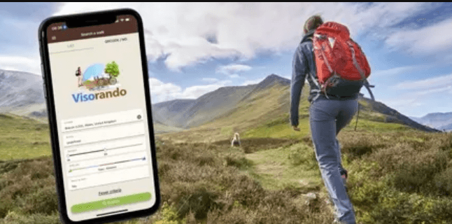
Visorando is a free mobile app that allows users to search for walks and find detailed directions. These routes are checked by a team of moderators before being shared with the community. The app also offers a free walking planner and access to licensed maps (OS Explorer and IGN) via PC.
It is a free hiking GPS app
If you’re looking for a free hiking GPS app that turns your phone into a walking guide, Visorando is the perfect solution. The app allows you to search for routes by location, activity and difficulty level and shows you a list of walks that match your criteria. You can also refine your search by entering additional criteria such as duration and circularity. Once you’ve found a route, you can download it for offline use. The GPS will automatically follow the route and warn you if you’re off track.
The app also includes a number of tools that make hiking easier. You can record a track of your walk, share it with the community or export GPX files to other devices. You can also save routes to follow with GPS tracking, which is especially useful when you’re hiking in remote areas and don’t have a data connection.
To start using Visorando, visit the Gillian’s Walks website and select a route from one of the categories. You will see a purple button on the page that says “Download/follow this walk on your mobile”. The app will open and display a map of the route. It will also show a description of the route if it’s been moderated. You can also create your own track using the free walking planner available on the website via PC (you will need to subscribe to Club Visorando to access licensed maps). This is a great way to challenge yourself and give purpose to each step of your journey.
It offers a variety of routes
Whether you are a beginner or an experienced walker, Visorando offers a variety of routes for every level. Once you find a walk that you enjoy, you can add it to your favourites and download the detailed map on your phone. The app also provides useful information such as the route’s difficulty, terrain type and the distance. Then, you can use the GPS function to follow the exact route on your walk.
The app offers a free version, but you need to pay to subscribe to Club Visorando to access licensed maps like OS Explorer and IGN. During the first three days after your initial login, you can access these maps free of charge. You can also use the OpenStreetMap layer for free, even after you’ve passed the trial period.
If you are interested in hiking, then you should consider downloading the Visorando app for free from the Android or Apple store. Once you have installed the app, you can browse through the Chiltern Society walks and choose one that suits your abilities. If you’re a beginner, you can start with the easier routes, and gradually increase your intensity. When you’re finished, you can share the results of your hike with friends or other users. The app will even warn you if you’re not on the right track!
Read also Navigating Through the Storm: How a Domestic Violence Attorney Can Help?
It is easy to use
Visorando is an app that turns your mobile phone into a GPS and offers a wide range of walking routes. It has a library of walks moderated by volunteers from across the UK and France, and also allows users to record their own tracks. The app is free to download and use, but if you want access to the more advanced features, you will need to subscribe to Club Visorando.
The app lets you know your position in real time and provides accurate directions. It also has a map layer that uses OpenStreetMap, and you can save it for offline use. The basic tools are free to use, but if you want to get detailed licensed maps such as OS Explorer and IGN, you will need to subscribe to the paid version of the app, Club Visorando.
It offers a subscription service
Le service de subscription Visorando permet aux randonneurs de suivre le chemin à travers des montagnes en toute sécurité. La fonction d’éclairage et de son système arrière vous permet de détecter les autres randonneurs et éviter la perte de votre trace. Chaque étape du trajet est indiquée sur le terrain et indiquée dans l’application. Il existe aussi un commentaire de randonneurs et des informations pratiques pour le mieux se préparer au travail à partir de la randonnée.
The app has a library of more than 3,000 moderated walks from across France and the United Kingdom. The library includes everything from Sunday strolls to strenuous mountain hikes and long-distance trails. There are 16 moderators from France and the UK who volunteer their time to help create this amazing resource.
The app is free to download but a subscription is required to access advanced features such as the route planner and access to licensed maps. The application comes with OS Explorer and IGN maps for free for 3 days after your first login, then you can subscribe to Club Visorando for a monthly or annual fee.