
If you live near a river, stream, or in an area prone to heavy rainfall, understanding overland flow and its impact on your property is crucial. Overland flow assessments provide valuable insights into how water moves across the land surface, which is essential for managing flood risks. This article will explain what overland flow is, the importance of these assessments, and how they can help residents protect their homes and communities.
What is Overland Flow?
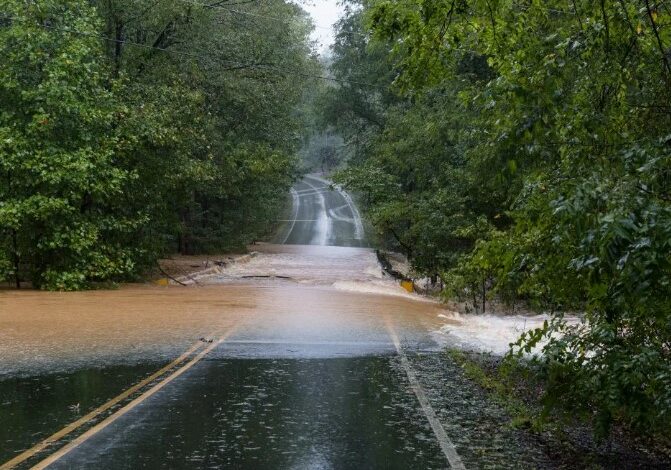
Overland flow refers to the movement of water over the land’s surface, typically after rainfall or snowmelt, when the ground is unable to absorb all the water. This can happen due to saturated soils, impervious surfaces like roads and pavements, or heavy precipitation events. Overland flow can lead to localized flooding, soil erosion, and can carry pollutants into nearby water bodies. Understanding how overland flow occurs on your property is the first step in mitigating its potential impacts.
The Importance of Overland Flow Assessments
Overland flow assessments are critical for residents in flood-prone areas as they help identify potential flood risks and inform mitigation strategies. These assessments provide detailed information about how water moves across a landscape, which areas are most vulnerable to flooding, and how different factors like topography, soil type, and vegetation cover influence water flow. By conducting an overland flow assessment, homeowners and local authorities can better prepare for and respond to flooding events, ultimately protecting lives, properties, and the environment.
Components of an Overland Flow Assessment
An overland flow assessment typically involves several key components. First, it includes a detailed analysis of the topography, which helps determine how water will move across the land during rainfall. This involves using maps, surveys, and sometimes advanced technologies like LiDAR to create a detailed terrain model.
Second, the assessment considers soil types and their infiltration capacities, as different soils absorb water at different rates. Third, it evaluates land use and vegetation cover, as these can significantly impact water flow. Finally, the assessment may include hydrological modeling to simulate different rainfall scenarios and predict how water will behave during these events.
How Overland Flow Assessments Help Residents
Overland flow assessments provide valuable insights that help residents make informed decisions about their properties and safety. By understanding the specific flood risks associated with overland flow, homeowners can take proactive measures to protect their homes. This might include landscaping changes to direct water away from the house, installing drainage systems, or creating retention areas to manage excess water.
Additionally, these assessments can inform building codes and land-use planning, ensuring that new developments are designed with flood risks in mind. For those considering purchasing property in a flood-prone area, overland flow assessments can be a critical factor in the decision-making process.
Read also: Reconnect with Nature: The Best Self-Care Ideas in Wild Outdoors
Steps Homeowners Can Take Based on Overland Flow Assessments
Based on the findings of an overland flow assessment, homeowners can implement several strategies to mitigate flood risks. One effective approach is to improve the landscape around the home to enhance water absorption and direct runoff away from the building. This might involve grading the land, planting native vegetation, and installing rain gardens or swales. Additionally, homeowners can install rain barrels and other water storage solutions to capture and reuse rainwater.
Ensuring that gutters and downspouts are clear and functional is also crucial, as these systems help manage roof runoff. In more severe cases, homeowners might consider more substantial modifications like elevating the home or adding flood barriers.
The Role of Local Authorities in Managing Overland Flow
Local authorities play a vital role in managing overland flow and mitigating flood risks for the community. They are responsible for conducting large-scale overland flow assessments, maintaining and upgrading drainage infrastructure, and implementing land-use policies that consider flood risks. Authorities also provide resources and support for residents, including information on flood preparedness and response.
By working closely with homeowners and community organizations, local governments can develop comprehensive flood management plans that address the unique challenges of their area. Public education campaigns and community engagement are also crucial components of effective flood risk management.
Conclusion
Understanding overland flow and its impacts is essential for residents of flood-prone areas. Overland flow assessments provide detailed insights into how water moves across the land, helping homeowners and local authorities develop effective flood mitigation strategies. By taking proactive measures based on these assessments, residents can protect their properties and contribute to the overall resilience of their communities. Whether you are already living near a body of water or considering purchasing property in such an area, staying informed and prepared is your best defense against the challenges posed by overland flow and flooding.